General Mapotic API Tutorial
API Swagger documentation
Authorization
To work with the map via API, you must log in with either the map administrator account or one of the emails assigned as a co-administrator (valid for the PRO plan and above).
When the user logs in, it sends an API token that can be used to access all endpoints in the project. User authorization is then done by adding the http header Authorization: token <token>.
|
Login |
https://www.mapotic.com/api/v1/auth/login/ POST email, password |
Map endpoints
Map detail | https://www.mapotic.com/api/v1/maps/map_ID/ |
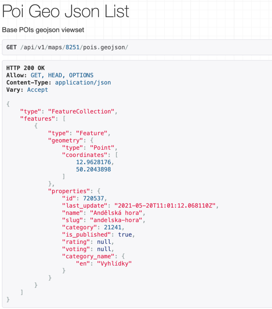
Places list (geojson) | https://www.mapotic.com/api/v1/maps/map_ID/pois.geojson/ |
Place detail | https://www.mapotic.com/api/v1/maps/map_ID/public-pois/<poi_id>/ |
Categories | https://www.mapotic.com/api/v1/maps/map_ID/public-categories/ |
Attributes | https://www.mapotic.com/api/v1/maps/map_ID/attributes_for_filtering/ https://www.mapotic.com/api/v1/maps/map_ID/attributes/ |
Sections | https://www.mapotic.com/api/v1/maps/map_ID/section/ |
Images | https://www.mapotic.com/api/v1/maps/map_ID/pois/POI_ID/images/ |
Parameters that can be used to filter individual endpoints can be found at this link: https://mapotic.github.io/mapotic.com-api-docs/
Filtering
Filtering is done using parameters when using an endpoint for a list of locations https://www.mapotic.com/api/v1/maps/2941/attributes_for_filtering/
Parameter name | Values of the parameters |
extra_fields | owner, created, address |
image | SIZExSIZE (ex. 240×240) |
attrID (ex. attr14823) | The value obtained from the endpoint for attributes (value key), used for filtering. |
					Example:
https://www.mapotic.com/api/v1/maps/8251/pois.geojson/?attr14823=Ubytovani,Restaurace&attr14888=Priroda&image=360x360&extra_fields=owner,created

Table of Contents
You might be also interested
More user activity stats for map administrators 🪄
To give map administrators a better overview of the content users have contributed to their map, we recently updated the Followers section with more statistics
Enhanced collaboration roles
We have recently updated the Users & Permissions section in the Mapotic Map Builder. The UI when adding map administrators or users with access to
New feature: Labels
The newest addition to the list of Mapotic attributes is called Label. It can be used to add additional labels (tags) to a place, route